Internship And Acadamic Project Work
ESRT offers a wide range of industrial and real time research projects under the supervision of experienced GIS professionals. We organize special training events in areas of high skill requirement. Classroom instructions are available at our centre for accomplishing complex GIS projects.
We also provides online GIS project guidance for remotely placed students.
Projects Completed and on Research using GIS and Remote sensing as mentioned below.
1.Map showing the crime rate by using GIS
2.Creation of Map to identify the damaged and undamaged trees, with different vegetation and Layout creation
3.Map depicting to identify the Camera-Trap for Bengal Tiger at Bannerghatta National Park
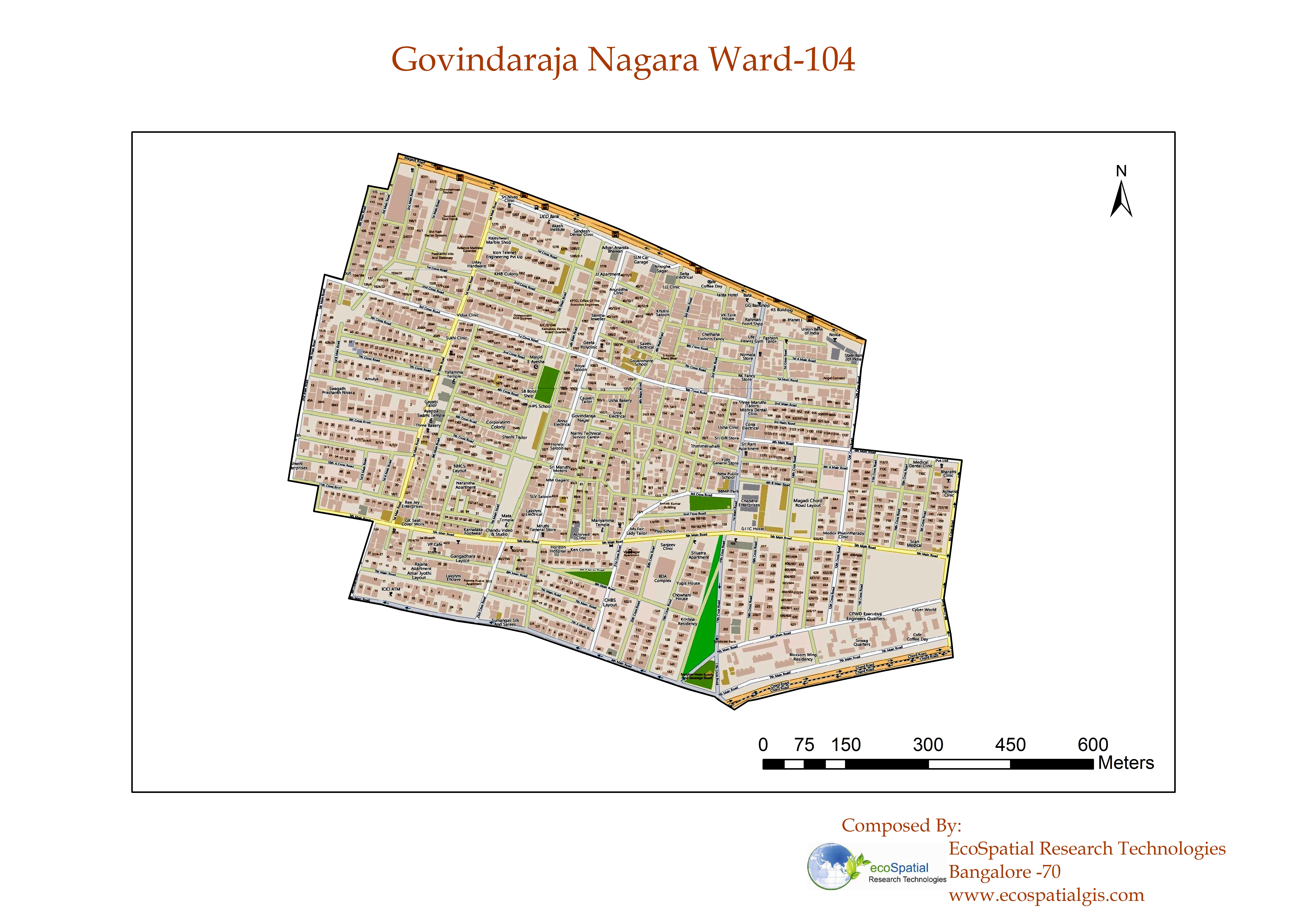
4.Ward Informatic Map
5.Map depicting Elephant ranging from BNP
6.Map depicting Honey Badger ranging in Cauvery Basin
7.Smart Ward Management
8.Map depicting Elephant ranging from BNP
9.Noise Pollution Analysis for Chennai
10.Map depicting the extent of habitat use by captive elephants during free-ranging at BNP
11.Map Showing Human Leopard Conflict at BNP
12.Map which shows Polling Booth for Assembly Election using GIS Analysis
Duration: 1 to 3 months with Exp letter. (Maximum 3 to 4 Students in a group)